Eyes in the Sky: Unveiling the Satellite-Driven Revolution in Air Quality and Atmospheric Science
- Market Overview: The Expanding Role of Satellites in Air Quality and Atmospheric Chemistry
- Technology Trends: Cutting-Edge Satellite Solutions and Analytical Advances
- Competitive Landscape: Key Players and Strategic Initiatives
- Growth Forecasts: Market Projections and Emerging Opportunities
- Regional Analysis: Geographic Hotspots and Adoption Patterns
- Future Outlook: The Next Frontier in Satellite-Based Environmental Monitoring
- Challenges & Opportunities: Navigating Barriers and Unlocking Potential
- Sources & References
“Atmospheric chemistry is the study of the chemical composition of the Earth’s atmosphere and the reactions and interactions that determine this composition.” (source)
Market Overview: The Expanding Role of Satellites in Air Quality and Atmospheric Chemistry
Satellites have become indispensable tools in the monitoring and analysis of air quality and atmospheric chemistry, offering unprecedented global coverage and real-time data. Traditionally, ground-based monitoring stations provided localized air quality measurements, but their limited spatial reach left significant gaps, especially in remote or developing regions. The advent of advanced satellite technology has bridged these gaps, enabling comprehensive observation of pollutants and atmospheric constituents on a global scale.
Modern satellites, such as NASA’s Aura and the European Space Agency’s Sentinel-5P, are equipped with sophisticated sensors capable of detecting a wide range of atmospheric pollutants, including nitrogen dioxide (NO2), sulfur dioxide (SO2), ozone (O3), carbon monoxide (CO), and particulate matter. For example, Sentinel-5P’s TROPOspheric Monitoring Instrument (TROPOMI) provides daily global maps of key air pollutants at high spatial resolution, allowing scientists and policymakers to track pollution sources, transport, and trends with remarkable detail (ESA).
Recent data highlight the growing impact of satellite observations. According to the World Meteorological Organization (WMO), satellite-derived air quality data now complement and, in some regions, surpass ground-based networks in coverage and frequency. This has been particularly valuable for monitoring transboundary pollution events, such as wildfire smoke plumes and dust storms, which can travel thousands of kilometers and affect air quality far from their source.
Furthermore, satellite data are increasingly integrated into air quality forecasting models and public health advisories. For instance, the U.S. AirNow program uses satellite information to provide real-time air quality updates for cities worldwide. The global satellite remote sensing market for environmental monitoring, including air quality, is projected to grow at a compound annual growth rate (CAGR) of over 8% through 2028 (MarketsandMarkets).
- Satellites offer global, near-real-time air quality data.
- They enable monitoring of pollutants in regions lacking ground stations.
- Satellite data support early warning systems and policy decisions.
- The market for satellite-based environmental monitoring is rapidly expanding.
In summary, satellites are revolutionizing the field of air quality and atmospheric chemistry, providing critical insights that drive research, policy, and public health initiatives worldwide.
Technology Trends: Cutting-Edge Satellite Solutions and Analytical Advances
Satellites have become indispensable tools in monitoring air quality and atmospheric chemistry, offering unprecedented global coverage and real-time data that ground-based sensors alone cannot provide. The latest generation of Earth observation satellites, such as the European Space Agency’s Sentinel-5P and NASA’s AIRS (Atmospheric Infrared Sounder), are equipped with advanced spectrometers and imaging technologies. These instruments can detect and quantify a wide range of pollutants, including nitrogen dioxide (NO2), sulfur dioxide (SO2), ozone (O3), and particulate matter, at high spatial and temporal resolutions.
One of the most significant advances is the ability to track pollution sources and transport pathways across continents. For example, Sentinel-5P’s TROPOMI instrument provides daily global maps of key atmospheric gases, enabling scientists and policymakers to monitor urban smog, wildfire emissions, and industrial pollution in near real-time. This data is crucial for understanding transboundary pollution events and for verifying compliance with international air quality agreements.
Analytical advances are also transforming how satellite data is used. Machine learning and data fusion techniques now allow researchers to integrate satellite observations with ground-based measurements and atmospheric models, resulting in more accurate and actionable air quality forecasts. For instance, the TEMPO mission, launched in 2023, is the first space-based instrument to monitor air pollution hourly over North America, providing granular insights into diurnal pollution patterns and exposure risks.
- Global Reach: Satellites provide consistent, high-frequency data across regions lacking ground infrastructure, such as developing countries and remote areas (WHO).
- Early Warning: Real-time monitoring supports rapid response to pollution spikes from wildfires, dust storms, or industrial accidents (NASA Earth Observatory).
- Policy Impact: Satellite data underpins air quality regulations and public health advisories, and supports research into the links between pollution and disease (Nature).
As satellite technology and analytical methods continue to evolve, their role in air quality and atmospheric chemistry monitoring will only grow, driving smarter policies and healthier communities worldwide.
Competitive Landscape: Key Players and Strategic Initiatives
Satellites have become indispensable tools in monitoring air quality and atmospheric chemistry, offering unprecedented spatial and temporal coverage. The competitive landscape in this sector is shaped by a mix of government agencies, private companies, and international collaborations, each leveraging advanced satellite technologies to provide actionable environmental intelligence.
- NASA: As a global leader, NASA operates several key missions such as the Terra, Aura, and TEMPO satellites. TEMPO, launched in 2023, is the first space-based instrument to monitor major air pollutants hourly across North America, providing data on ozone, nitrogen dioxide, and formaldehyde at a resolution of up to 10 square kilometers (NASA).
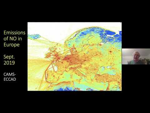
- European Space Agency (ESA): ESA’s Sentinel-5P satellite, part of the Copernicus program, has been operational since 2017. It delivers daily global data on key atmospheric gases, including nitrogen dioxide, ozone, and methane, supporting both policy and research efforts (Copernicus).
- China National Space Administration (CNSA): CNSA’s Gaofen series includes satellites equipped with hyperspectral sensors for air quality monitoring, supporting China’s aggressive environmental policy goals.
- Private Sector: Companies like Planet Labs and GHGSat are innovating with high-resolution commercial satellites. GHGSat, for example, specializes in detecting and quantifying greenhouse gas emissions from individual facilities, with its latest satellite, Vanguard, launched in 2023 (GHGSat).
Strategic initiatives include cross-border data sharing, public-private partnerships, and integration of satellite data with ground-based sensors and AI analytics. The Global Earth Observation System of Systems (GEOSS) exemplifies international collaboration, pooling data from multiple sources to enhance global air quality monitoring. As satellite technology advances, competition is intensifying around data accuracy, frequency, and value-added analytics, driving innovation and expanding the market for environmental intelligence services.
Growth Forecasts: Market Projections and Emerging Opportunities
Satellites are rapidly transforming the landscape of air quality monitoring and atmospheric chemistry analysis, offering unprecedented spatial and temporal coverage. The global satellite-based Earth observation market, which includes air quality applications, is projected to grow from USD 4.6 billion in 2023 to USD 7.0 billion by 2028, at a CAGR of 8.7%. This growth is fueled by increasing demand for real-time, high-resolution data to inform environmental policy, public health, and industrial compliance.
Recent advances in satellite technology—such as the launch of the European Space Agency’s Sentinel-5P and NASA’s TEMPO mission—have enabled the detection of key pollutants (NO2, SO2, O3, PM2.5, and VOCs) at finer scales than ever before. These satellites provide daily global coverage, allowing for near real-time tracking of pollution events, wildfire smoke, and transboundary haze. According to NASA, the TEMPO instrument, launched in 2023, is the first to monitor air pollution hourly across North America at neighborhood-level resolution.
- Market Projections: The air quality monitoring segment is expected to see robust growth, with the satellite-based air quality monitoring market alone anticipated to reach $8.9 billion by 2028, driven by regulatory mandates and public health concerns.
- Emerging Opportunities: Integration of satellite data with ground-based sensors and AI analytics is opening new avenues for hyperlocal forecasting, urban planning, and industrial emissions management. Startups and established players are leveraging these datasets to develop commercial products for insurance, agriculture, and smart city applications.
- Policy and Compliance: Governments are increasingly relying on satellite data to enforce air quality standards and track progress toward climate goals. The European Union’s Copernicus program and the US EPA’s adoption of satellite-derived data for regulatory purposes exemplify this trend.
In summary, satellites are not only enhancing our understanding of atmospheric chemistry but also creating significant commercial and policy opportunities. As technology advances and data becomes more accessible, the role of satellites in air quality management is set to expand dramatically over the next decade.
Regional Analysis: Geographic Hotspots and Adoption Patterns
Satellites have become indispensable tools in monitoring air quality and atmospheric chemistry, offering unprecedented spatial and temporal coverage. Their adoption is not uniform worldwide; instead, certain geographic hotspots have emerged as leaders in leveraging satellite data for environmental management and policy-making.
- North America and Europe: These regions are at the forefront of satellite-based air quality monitoring. Agencies like NASA and the European Space Agency (ESA) operate advanced satellites such as Sentinel-5P and Terra, which provide high-resolution data on pollutants like nitrogen dioxide (NO2), sulfur dioxide (SO2), and particulate matter. The Copernicus Atmosphere Monitoring Service integrates this data for real-time air quality forecasts, supporting both regulatory compliance and public health advisories.
- East Asia: Rapid industrialization and urbanization have made air quality a critical issue in countries like China, South Korea, and Japan. China’s Gaofen and Japan’s GOSAT satellites are instrumental in tracking emissions and transboundary pollution. According to the Nature journal, satellite data has been pivotal in verifying the effectiveness of China’s air pollution control policies, showing a 40% reduction in NO2 levels in major cities between 2013 and 2020.
- South Asia: India and neighboring countries face severe air pollution episodes, especially during winter. The INSAT-3D and INSAT-3DR satellites, operated by ISRO, provide critical data for tracking aerosol and dust movement. International collaborations, such as the AIRS instrument on NASA’s Aqua satellite, further enhance regional monitoring capabilities.
- Emerging Regions: Africa and Latin America are increasingly adopting satellite-based monitoring, often through partnerships with international agencies. The launch of Africa’s first air quality monitoring satellite in 2022 marked a significant milestone, enabling better tracking of urban and wildfire emissions.
Overall, satellite technology is democratizing access to atmospheric data, enabling both developed and developing regions to address air quality challenges with greater precision and timeliness. As satellite constellations expand and data becomes more accessible, adoption is expected to accelerate globally, driving more informed policy and public health interventions.
Future Outlook: The Next Frontier in Satellite-Based Environmental Monitoring
Satellites are rapidly transforming the landscape of air quality monitoring and atmospheric chemistry analysis, offering unprecedented global coverage, real-time data, and high-resolution insights. As urbanization and industrialization intensify, the need for accurate, timely, and comprehensive air quality data has never been greater. Traditional ground-based monitoring stations, while precise, are limited in spatial coverage and often concentrated in developed regions. In contrast, satellite-based systems provide a holistic view, capturing data across remote, urban, and rural areas alike.
Recent advancements in satellite technology have enabled the detection and quantification of key atmospheric pollutants such as nitrogen dioxide (NO2), sulfur dioxide (SO2), ozone (O3), carbon monoxide (CO), and particulate matter (PM2.5). Instruments like NASA’s TEMPO (Tropospheric Emissions: Monitoring of Pollution), launched in 2023, are capable of hourly measurements of air pollutants over North America at a spatial resolution of up to 2 square kilometers. Similarly, the European Space Agency’s Sentinel-5P satellite, equipped with the TROPOMI instrument, delivers daily global maps of atmospheric gases, supporting both scientific research and policy-making.
These “eyes in the sky” are not only enhancing our understanding of pollution sources and transport but are also critical for early warning systems and disaster response. For example, satellite data played a pivotal role in tracking the spread of smoke from the 2023 Canadian wildfires, informing public health advisories across North America (NASA Earth Observatory).
Looking ahead, the integration of satellite data with artificial intelligence and machine learning is expected to further revolutionize air quality forecasting and atmospheric modeling. The upcoming Meteosat Third Generation and GeoCarb missions promise even higher temporal and spatial resolution, enabling near-real-time monitoring of greenhouse gases and pollutants. As satellite constellations expand and data accessibility improves, the next frontier in environmental monitoring will be characterized by greater accuracy, timeliness, and actionable insights—empowering governments, businesses, and communities to make informed decisions for a healthier planet.
Challenges & Opportunities: Navigating Barriers and Unlocking Potential
Satellites have become indispensable tools in monitoring air quality and atmospheric chemistry, offering unprecedented global coverage and real-time data. However, the integration of satellite technology into environmental monitoring presents both significant challenges and promising opportunities.
-
Challenges in Satellite-Based Air Quality Monitoring
- Spatial and Temporal Resolution: While satellites like NASA’s Aura and ESA’s Sentinel-5P provide global data, their spatial resolution (often several kilometers) can limit the detection of localized pollution events, especially in urban microenvironments.
- Vertical Profiling Limitations: Most satellite sensors measure total column concentrations, making it difficult to distinguish between surface-level pollution (which affects human health) and higher-altitude concentrations. This complicates direct comparisons with ground-based monitoring stations (Nature).
- Cloud Cover and Aerosol Interference: Cloudy conditions and high aerosol loads can obscure satellite readings, leading to data gaps or uncertainties, particularly in regions with frequent cloud cover (MDPI).
- Data Integration and Calibration: Harmonizing satellite data with ground-based measurements requires complex calibration and validation efforts, as differences in measurement techniques can introduce discrepancies (EPA).
-
Opportunities and Potential Unlocks
- Global and Near-Real-Time Coverage: Satellites enable continuous, borderless monitoring of pollutants such as NO2, SO2, and PM2.5, supporting early warning systems and transboundary pollution tracking (NASA Earth Observatory).
- Data-Driven Policy and Research: High-frequency satellite data empowers policymakers to assess the effectiveness of air quality regulations and respond rapidly to pollution events. For example, satellite observations revealed dramatic drops in NO2 during COVID-19 lockdowns, informing future emission reduction strategies (Nature).
- Technological Advancements: New missions, such as NASA’s TEMPO (Tropospheric Emissions: Monitoring of Pollution), promise hourly, high-resolution data over North America, bridging the gap between satellite and ground-based observations.
- Public Engagement and Accessibility: Open-access satellite data platforms democratize information, enabling researchers, governments, and the public to monitor air quality and advocate for cleaner air (NASA Air Quality).
As satellite technology evolves, overcoming current barriers will unlock even greater potential for understanding and managing air quality and atmospheric chemistry on a global scale.
Sources & References
- Eyes in the Sky: How Satellites Are Revolutionizing Air Quality and Atmospheric Chemistry
- Aura
- Sentinel-5P
- World Meteorological Organization (WMO)
- U.S. AirNow program
- USD 4.6 billion in 2023 to USD 7.0 billion by 2028
- TROPOMI
- GeoCarb
- WHO
- NASA Earth Observatory
- Nature
- TEMPO
- Copernicus Atmosphere Monitoring Service
- Gaofen
- Planet Labs
- GHGSat
- $8.9 billion by 2028
- GOSAT
- INSAT-3DR
- Meteosat Third Generation
- NASA Air Quality